

Presented by our Friends Of The Porpoise at Wave Riding Vehicles, check ’em out here https://www.waveridingvehicles.com
Atmospheric and oceanic conditions still favor an above-normal 2022 Atlantic hurricane season, according to National Ocean and Atmospheric Administration ( NOAA ) who just released their annual August update issued August 4th by the Climate Prediction Center, a division of the National Weather Service.

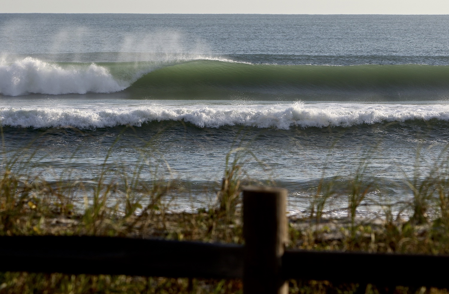
Balaram Stack, Hurricane Henri, Long Island, NY. You can bet this guy has his eye’s peeled and ready to pounce when the first hurricane swells start showing themselves no matter where in the world he is. Photo: Mike Nelson
NOAA forecasters have slightly decreased the likelihood of an above-normal Atlantic hurricane season to 60% (lowered from the outlook issued in May, which predicted a 65% chance). The likelihood of near-normal activity has risen to 30% and the chances remain at 10% for a below-normal season.
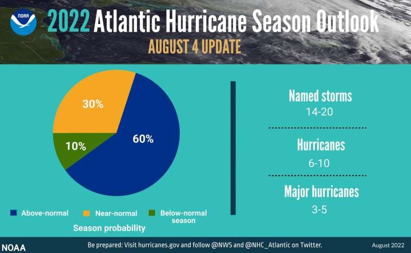
The August 4th NOAA updated 2022 hurricane season pie chart. Courtesy NOAA
The Atlantic hurricane season has been in slumber for nearly a month, but don’t expect it to remain quiet for too much longer because the peak of hurricane season is on the way according to the National Ocean and Atmospheric Administration ( NOAA ) that just released their annual August update.
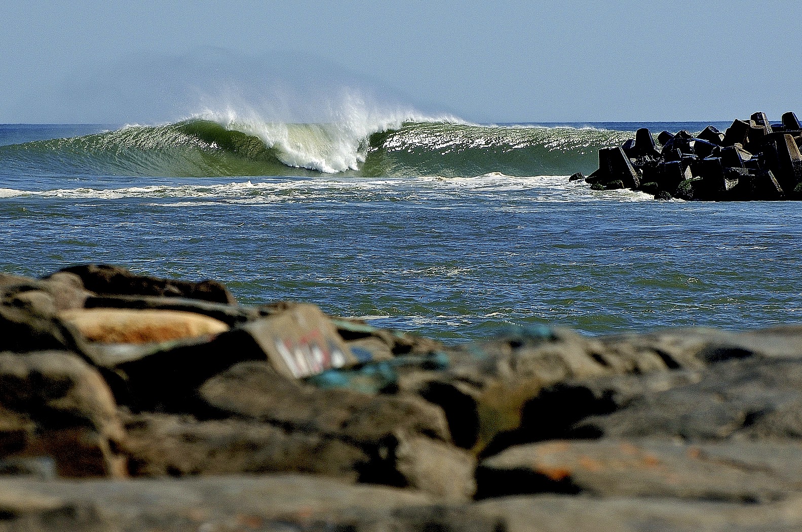
Waiting for the next named storm, Danielle. In the mean time here’s a reminder of things to come. Hopefully. Brevard County blowing up! PHOTO : @tomduganphotos
“We’re just getting into the peak months of August through October for hurricane development, and we anticipate that more storms are on the way,” said NOAA Administrator Rick Spinrad, Ph.D. “NOAA stands ready to deliver timely and accurate forecasts and warnings to help communities prepare in advance of approaching storms.”
NOAA’s update to the 2022 outlook—which covers the entire six-month hurricane season that ends on Nov. 30—calls for 14–20 named storms (winds of 39 mph or greater), of which 6–10 could become hurricanes (winds of 74 mph or greater). Of those, 3–5 could become major hurricanes (winds of 111 mph or greater). NOAA provides these ranges with a 70% confidence.

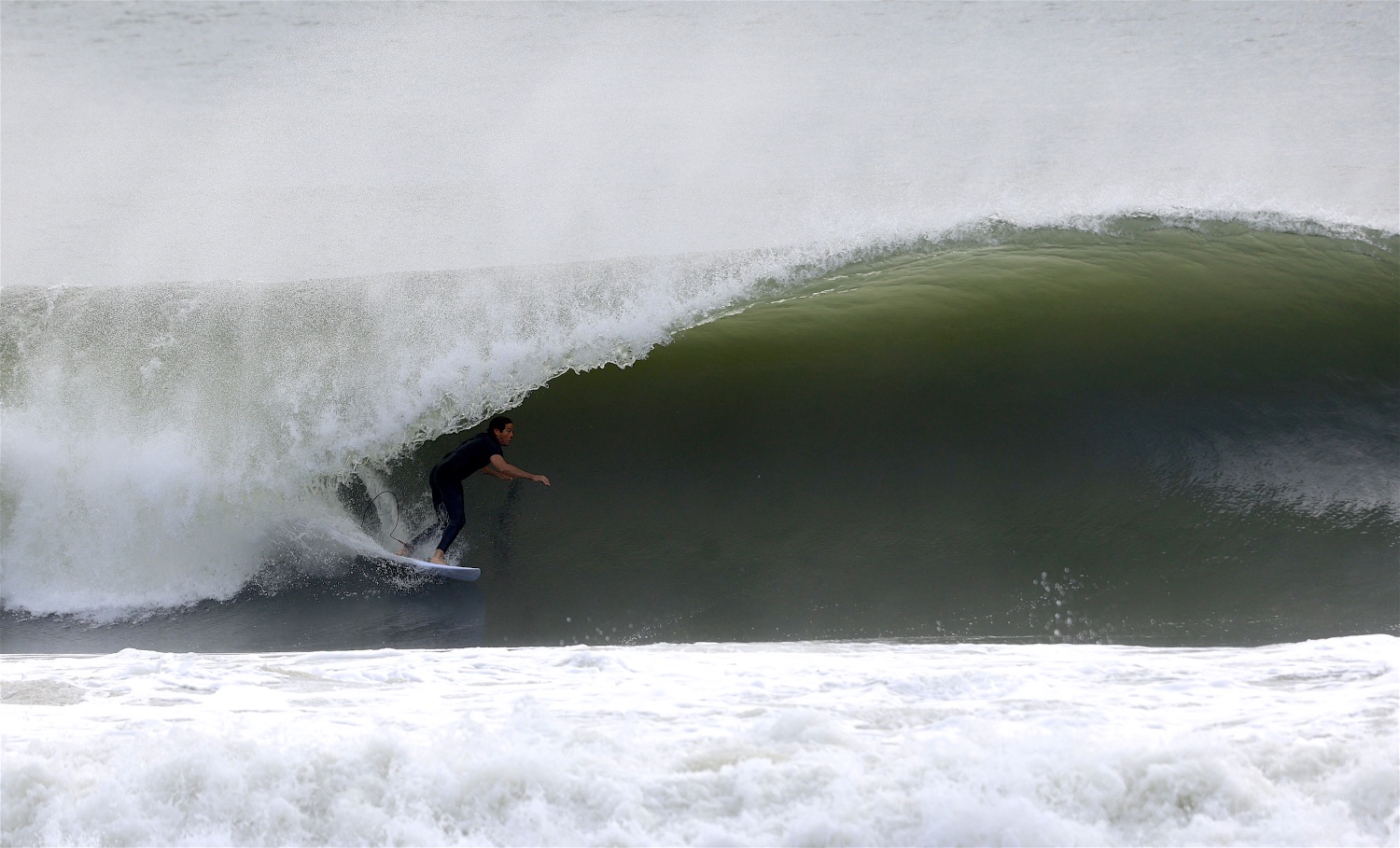
Jeff Myers during hurricane Sam at P-Land on the Outer Banks, NC. Photo and GIF sequence below by Mez @mezapixels
So far, the season has seen three named storms and no hurricanes in the Atlantic Basin. An average hurricane season produces 14 named storms, of which seven become hurricanes, including three major hurricanes.
This outlook is for overall seasonal activity, and is not a landfall forecast. Landfalls are largely governed by short-term weather patterns that are currently only predictable within about one week of a storm potentially reaching a coastline.
Three down, how many more to go? Yep, It’s been excruciatingly slow season so far but remember last year whit the 2021 season racking up 21 names storms and ran the entire alphabet From Ana To Wanda. Courtesy NOAA
There are several atmospheric and oceanic conditions that still favor an active hurricane season. This includes La Niña conditions, which are favored to remain in place for the rest of 2022 and could allow the ongoing high-activity era conditions to dominate, or slightly enhance hurricane activity. In addition to a continued La Niña, weaker tropical Atlantic trade winds, an active west African Monsoon and likely above-normal Atlantic sea-surface temperatures set the stage for an active hurricane season and are reflective of the ongoing high-activity era for Atlantic hurricanes.
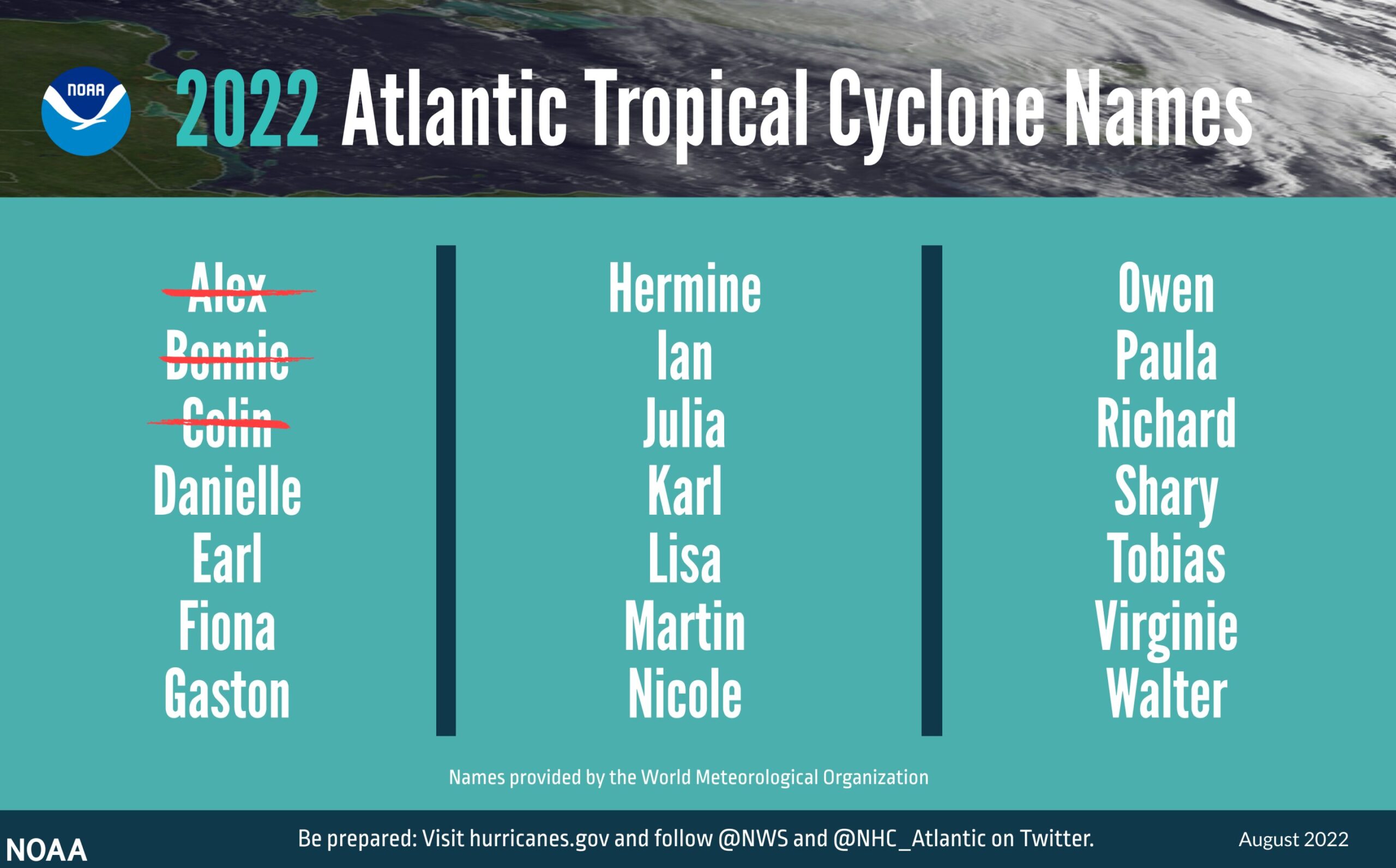
Tropical Storm Colin, which briefly impacted the coastal Carolinas with heavy rain and gusty winds on July 2 and 3, was the last system to roam the Atlantic Basin. However, it’s not unusual for not unusual for a lull in tropical activity in June and July before the season begins to ramp up in August so, since then, it’s been zilch, zip, nada and no bueno for surfers.

Noah Schweizer throwing hammers -sledge hammer sized – at New Smyrna during Hurricane Larry. Photo: Mez @mezapixels
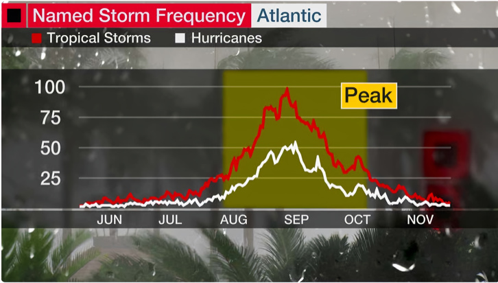
For some basic weather geek factoids between 1851 and 2020, only 6% of all tropical storms and 2% of all hurricanes roamed the Atlantic during June according to data from NOAA’s Atlantic Oceanographic and Meteorological Laboratory.
For comparison, September is the most active month of the Atlantic hurricane season and accounts for 40% of all tropical storms and 26% of all hurricanes on record.
But as you can see in the graph below, roughly 90% of an average Atlantic hurricane season is still remaining as we head into August.
Let the 2022 hurricane surf season finally begin ! Courtesy NOAA
The period from August through early October tends to produce the most hurricanes and tropical storms in an average year. September is the single most active month of the Atlantic hurricane season, with Sept. 10 marking the official seasonal peak.
Consequently, this same period is typically when the strongest, most impactful hurricanes roam the Atlantic Basin.
Just in in the last five years – from 2017 through 2021 – the US was struck by four hurricanes in August, five in September and four in October. That included last year’s Hurricane Ida which devastated parts of southeastern Louisiana after making landfall as a Cat 4 hurricane on August 29.
Hurricane Jerry delivered “the most incredible line-up’s I ever saw at Manasquan Inlet” according to long time NJ photog, Mike Vuocolo who been photographing this very same wave for close to 50 years. ‘Nuff said we say. Photo: Mike Voucolo @mikesshoreshots
The storm produced a powerful 14-foot storm surge along the Louisiana coastline and dumped torrential rainfall across much of the northern Gulf Coast, but its impacts didn’t stop there. The storm’s effects were also felt up the entire Eastern Seaboard, where tornadoes and flooding were reported as far north as New England.
Hurricane Ida was blamed for the deaths of more than 100 people, and its estimated damages topped $75 billion from the Caribbean to New England. The destruction was enough to propel the storm to the fifth-costliest hurricane in US history, ranking just behind Katrina, Harvey, Maria and Sandy, respectively.
The World Meteorological Organization voted in April 2022 to retire the name Ida from future use in the Atlantic Basin.
Jesse Hines line’s it up on Pea Island, NC during tropical storm Ana, the 2021 seasons first named tropical system. We can only dream and hope at this point. Photo: Mez @mezapixels
In her closing NHS statement released August 4th, FEMA administrator Deanne Criswell warns with these words to the wise:
“Although it has been a relatively slow start to hurricane season, with no major storms developing in the Atlantic, this is not unusual and we therefore cannot afford to let our guard down,” said FEMA Administrator Deanne Criswell. “This is especially important as we enter peak hurricane season—the next Ida or Sandy could still be lying in wait. That’s why everyone should take proactive steps to get ready by downloading the FEMA app and visiting Ready.gov or Listo.gov for preparedness tips. And most importantly, make sure you understand your local risk and follow directions from your state and local officials.” In other words folks, wax up your quiver because it’s a matter of if, not when and keep a keen weather eye because you can’t hurricane prep enough beforehand. – Mez –
![]()


